
Today our aim was to complete a simple day walk but complete some of the scientific work along the way. In simple terms we were going to the summit of Mt Drygalski, all 226 metres of it.
On leaving Base Camp Fred and I had a casual walk south along the foreshore of Walrus Bay as a warm up, and we needed it, overnight there had been a small fall of snow and the temperature had dropped accordingly.
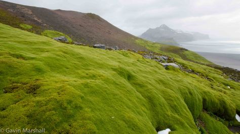
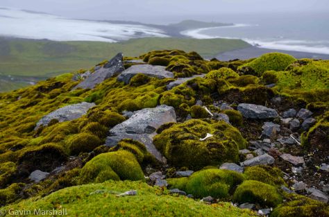 We left 2 of the light and temperature sensors at the southern end of the bay on the rock finger that reached out to us from Mt Drygalski and then started the short climb. The trick was to pick a line to climb that was clear of the lush green azorella plant and also avoided the small pea to tennis ball sized lava rocks that covered the hillside.
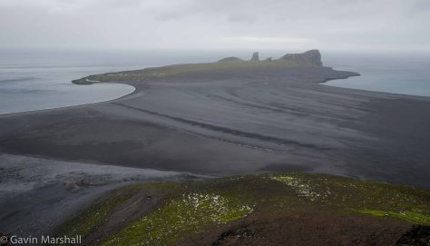 The view along the way is outstanding. North is the Azorella peninsula with Walrus Bay on the left and Corinthian Bay on the right. The unique rock formations of the far north of Azorella peninsula defy my explanation. All I can say is that the bands of different coloured rock that flow upward through the cliff face are impressive and I’m told are part of the Drygalski formation on which Heard Island sits.
By the time we reached the summit point the winds had increased to the pint that standing was a difficulty and shortened our stay to a few minutes.
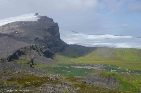 From the summit we headed east along the ridgeline and a view out over the Schmidt glacier and also over the King penguin rookery that we had visited several days before. It’s from here that we really get a view of the trek that these penguins make from the rookery to the sea. We had seen them ambling along when we followed their trail but from above the true magnitude of their trip is clear. Why don’t they move closer to the sea?
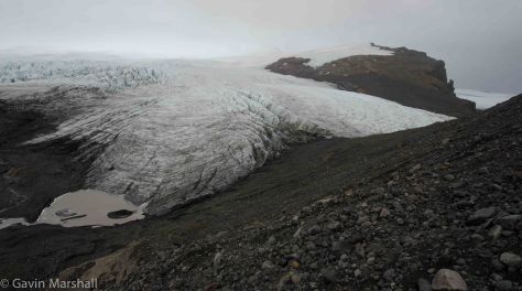 There are ridges of moraine rock in front of us that are just too tempting and I’ve convinced Fred that a walk along the far ridge will give us even better views over the Schmidt glacier. There are several small glacier lagoons that we see from the ridge and maybe on an other trip out this way we can get some time to investigate these.
 Our route of Mount Drygalski is relatively simple, stay high until we are clear of the cliff lines on the eastern end and then plunge down the lava and sand terraces to reach the sand flats before the short walk back into Base Camp.
Gavin


Fabulous photos Gavin. Great that you’ve had something deliver beyond your expectations. How rare a thing is that? Looking forward to catching up when you get home. BnV
LikeLike