It’s mid morning, Christmas Day, and we are already 2 hours up the Waimakariri River from our Klondye Corner starting point. We’ve been walking into the wind and just surprised 3 deer on the river flats and in only a few seconds they’ve assessed the situation, decided we are an immediate threat, selected their escape route and rapidly made an exit into a stand of trees approx 100 metres downstream. And that’s our excitement for the day as from here on it’s just more of the same, as we walk the river shingle all the way through to Carrington Hut.
That’s not to say that we see this as a chore. The 3 Passes trip was the original reason for coming into the Arthur’s Pass National Park – it’s a walk that I’ve had my eye on for almost 15 years and now it’s coming to fruition at last.
Carrington Hut is enormous – bunks for 30+ and floor space for as many again. But noisy – every gust of wind causes the large roof beams to move and squeak. There’s a number of interesting stories in the hut book about the original building of the hut, subsequent relocations and the characters that have made use of the hut over the years. These all make for light reading as we partake of a few celebratory Christmas drinks and prepare for the big day that is ahead of us tomorrow.
 By 8am on Boxing Day we are heading out the door to start the climb to Harman Pass, the first of 2 main passes that we’ll cross today. The Taipoiti River is a typical NZ alpine river – big rocks and even bigger boulders with a good flow of ice cold water. The track follows the stream bed and carves its way up the face towards the pass and as we draw near the there’s a significant series of waterfalls that cascade in on our left. We’ve been walking in mist most of the morning and our view comes and goes as the clouds swirl off the tops and around us as we continue the slow slog up and over Harman Pass.
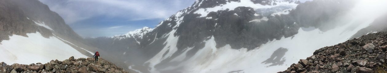
With the mist swirling around us, and visibility down to no more than 50m, Harman Pass is nothing more than a blur in my memory. I have a recollection of a trudge through rocky terrain with some huge  boulders thrown in for good measure, one or two tarns to skirt around and more mist. The push higher up takes us to the first tongue of snow that develops into the snow field that leads higher up to Whitehorn Pass.
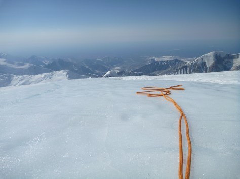
The snow is soft, almost slushy, and cutting steps takes nothing more than a forceful “footstep”, at times the step disintegrates and there’s more backward slide than forward progress but eventually we complete the 2-300 metres of vertical climb that brings us to Whitehorn Pass. The route guide describes the next step as “locate the large rock cairn on the left side of the pass and carefully descend from down the scree slopes into the Cronin Valley”. Key to this is finding the large cairn, and so after 15-20 minutes of fruitless  searching in the mist we give up and set our own path for descent. Once we navigate some bluffs it’s not like it’s a big issue, because there’s only one real option – downward over the scree to the Cronin Stream that’s expanding in flow from the huge number of snow melt streams that are dropping in off the Rosamond Ridge.
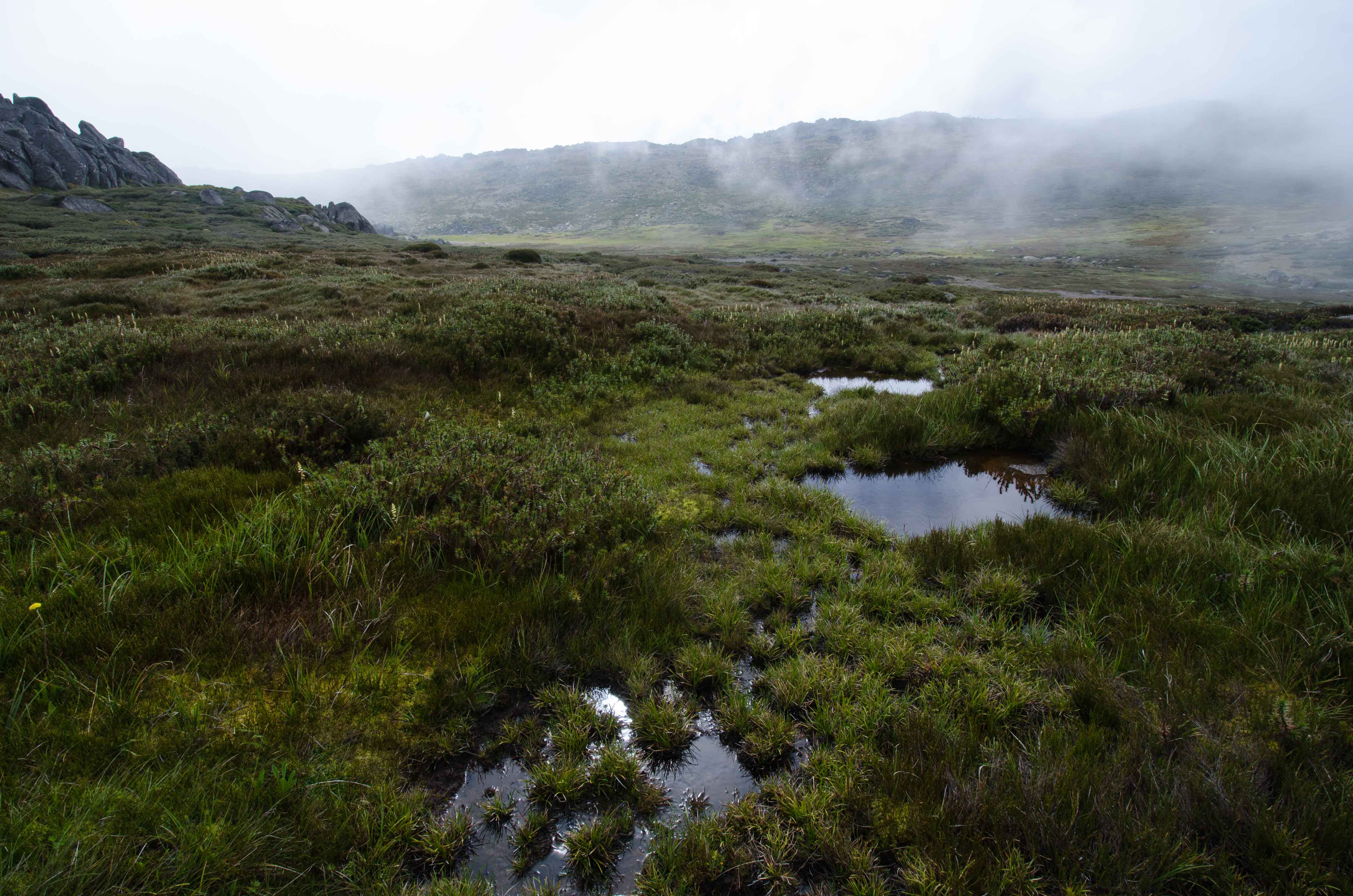
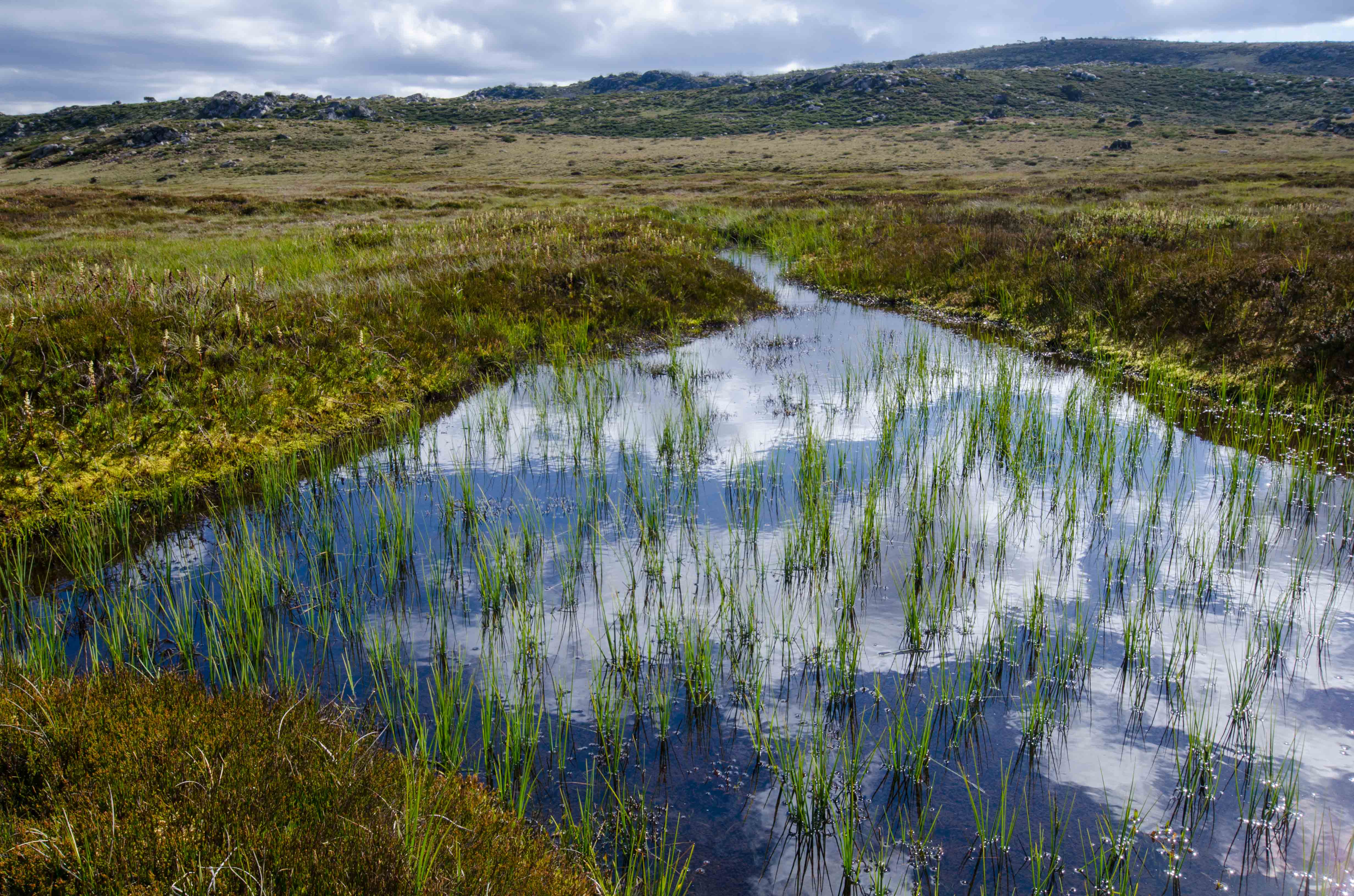
We take a break for a bite to eat an hour or two down the valley before continuing the march toward Park Morpeth Hut. This is “big country – high alpine ranges with deep valleys and strong flowing streams and rivers. There are signs of some “traffic” though the valley. We come across a cairned route for the later stage of the descent and the occasional footprint and walking pole mark suggests we may have company in the hut tonight.
 By mid afternoon we are completing the last river crossing, climbing the last scree slope and making the final descent to Park Morpeth Hut. Tomorrow has been declared a rest day!
A rest day it is, the rain has arrived just in time and there’s no motivation to push on to Harman Hut today. Park Morpeth Hut is one of the Canterbury Mountaineering club huts and true to form it is stocked with a “library” of CMC annual magazines that become the entertainment for the day. At one point I take a break, pull on some wet weather gear and head out to take photographs but generally it’s a low action day.
 The following day though we are primed for the climb up Browning Pass and the descent down the valley to Harman Hut. When you first look at the route to Harman Pass on the map you feel the feel the cartographer’s made an error – the contour lines appear to be all stacked on top of each other. By the time we pull ourselves up over the last 10 metres onto Harman Pass we realise that it’s us who have made the error – the contour lines are just as they should be!
 Bizarre as it sounds, in gold rush days Browning Pass was considered an option for a route from the east to west coast of NZ. The gold mines on the west coast were pulling the miners and shop keepers out of Canterbury, all they needed was a viable route for them and their horse and cart combinations to negotiate. The zig-zag track we take up to Browning Pass initially follows some of this old route – how they ever intended to get horse and cart up there is beyond me!
 Once on the pass the view is amazing. To the south west the Wilberforce River snakes back beyond our start point at Park Morpeth Hut. To the west there’s still snow pockets on the Marshal Ridge and the other surrounding peaks. To the north we have Browning Lake, Mt Harman and from our lunch spot we can see our next obstacle to negotiate to make Harman Hut for the night.
 A steep descent ensues, through the alpine grass terrain before finally dropping into the valley and following the un-named river, complete with numerous crossings, as we head downstream to the hut. The final leg of today’s journey has us following the “West Coast teams” contribution to West – East miners’ route. Although overgrown with scrub it’s easy to see that this team also made a significant contribution.
We overnight at Harman Hut along with 9 others walking the 3 Passes route, before making an early start on the final push out to the road end.
 Our final day is all about true NZ West Coast terrain – mud, slush and BOG! The track is well defined and just when you think you are making good progress you can step forward onto solid ground only to find that solid it’s not, and you are up to your knee in soft peat bog. Eventually we leave that behind and are on the banks of the Styx river and making good time. The lush native bush is fantastic to walk through, it’s
  something I never tire of and it’s topped off by my first ever sighting of the native NZ Blue Duck. And not 1, but a family of 9! That warrants a long stop for us to watch as they negotiate a crossing of the swiftly flowing river to put some distance between us. The Department of Conservation and ?? have a joint programme in place to reduce the number of predators and hopefully grow the Blue Duck population. If our sighting is any indication, this programme appears to be working.
 By 3pm we are lifting packs off our back for the last time and congratulating ourselves for completing the 3 Passes trek across the Southern Alps. It’s been a brilliant trip – the weather was good when it needed to be and poor when we wanted a hut day. The terrain tested us and proved we are on track for Mt Denali in May, and most of all it was just a fantastic trip with friends in the NZ outdoors.
Now for a cold beer in a West Coast pub!!


 Worsley biv provided another interesting find. 2 copies of the National Geographic. In itself not surprising – but the dates of the magazines and their almost perfect condition was! 1965 and 1974 – some interesting stories, but most entertaining were the advertisements, especially from the earlier edition. Advertisements for Eastman Kodak and Hasalblad cameras, Seiko wrist watches, ride on lawn movers, overseas holidays and colour televisions (the size of a small fridge) all signs of success for the then “modern” US family. And several pages of classified ad’s enticing parents to enrol their son’s for next years intake to military school.


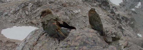
 End of day 1 and we haven’t seen or heard a kea, hopefully tomorrow will be a better day
 I expected this scene would be repeated many more times over the next 15 days , but no!! The closest we got to a repeat experience was the kea in Arthur’s Pass village that entertains the travellers. For the rest of our time in their “home” we heard a few on the far off bluffs, calling across the valleys, we saw several at distance, as they flew through the valleys but it was occasional at best and nothing to compare with our initial contact.
 And that’s the sad situation that the NZ kea is now in. Numbers are dwindling – not to the point that they are about to follow the moa into extinction. They aren’t in the “critically endangered list like the Kakapo but they need some outside assistance, like that provided by the Kea Conservation Trust to ensure they don’t go that way in the next few years.


 We initially set ourselves some reasonably ambitious targets and as has so often been the case when we return to NZ to go walking, the weather made all of the plans irrelevant. We arrived in Arthur’s Pass village on Sunday morning and made ourselves known to the Department of Conservation (DOC) team to find out that all rivers to the northern end of the park were at “extreme flood” levels and were impossible to cross.


 By late afternoon of day 5 we were back in Arthur’s Pass village, installed at the “Wobbly Kea” enjoying a cold beer and a hot pizza refining our plans for phase 2 of the trip – the 3 Passes walk through to Hokitika.